


SERVING ORANGE COUNTY AND SURROUNDING AREA
For more information visit www.paoliairporti42.com
Paoli Municipal Airport hereby announces its proposed Disadvantaged Business Enterprise (DBE) participation goal of 6.67% for FAA-funded contracts/agreements. The proposed goal pertains to federal fiscal years 2026 through 2028. A teleconference will be held on August 28, 2025 between 1:00-1:30 PM ET for the purpose of consulting with stakeholders to obtain information relevant to the goal-setting process.
Meeting ID: 266 451 127 891
Passcode: Cq9GD9UN
Comments on the DBE goal will be accepted for 30 days from the date of this publication and can be sent to the following:
Mr. Brent Pinnick
Board President
182 W. Applegate
Paoli, Indiana 47454
(812) 723-9923
PUBLIC NOTICE
Paoli Board of Aviation Commissioners hereby announces its proposed Disadvantaged Business Enterprise (DBE) participation goal of 7.6% for FAA-funded contracts/agreements. The proposed goal pertains to federal fiscal years 2023 through 2025. A teleconference will be held on November 11th, 2022 from 3:00-3:30 PM EST for the purpose of consulting with stakeholders to obtain information relevant to the goal-setting process. Please call the following number to participate in the teleconference: +1 937-240-2430
Conference ID: 221 897 50#.
Comments on the DBE goal will be accepted for 30 days from the date of this publication and can be sent to the following:
Vance Alden, Airport Manager
182 W. Applegate
Paoli, IN 47454
812-723-9923
VANCE ALDEN
8AM TO 5PM DAILY
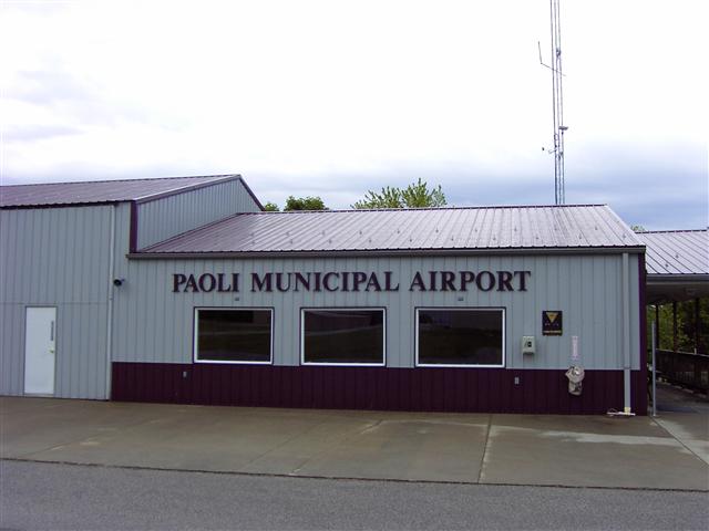
182 W APPLEGATE ST.
PAOLI, INDIANA 47454
OFFICE PHONE:
812-723-9923
FAX: 812-723-9923
EMAIL: paoliairport@yahoo.com

Paoli Aviation Board – (A four year term)
Term ending December 31, 2020
Term ending December 31, 2021
Term ending December 31, 2022 Brent Pinnick
Term ending December 31, 2023 Robert Lambert
FAA INFORMATION EFFECTIVE 31 DECEMBER 2020
Location
| FAA Identifier: | I42 |
| Lat/Long: | 38-35-07.6550N 086-27-52.7200W 38-35.127583N 086-27.878667W 38.5854597,-86.4646444 (estimated) |
| Elevation: | 816.2 ft. / 248.8 m (surveyed) |
| Variation: | 01W (1985) |
| From city: | 2 miles N of PAOLI, IN |
| Time zone: | UTC -5 (UTC -4 during Daylight Saving Time) |
| Zip code: | 47454 |
Airport Operations
| Airport use: | Open to the public |
| Activation date: | 07/1947 |
| Control tower: | no |
| ARTCC: | INDIANAPOLIS CENTER |
| FSS: | TERRE HAUTE FLIGHT SERVICE STATION |
| NOTAMs facility: | HUF (NOTAM-D service available) |
| Attendance: | MON-SUN 0800-1700 FOR AFTER HRS SERVICE CALL 208-599-5721 |
| Pattern altitude: | 2416.2 ft. MSL |
| Wind indicator: | lighted |
| Segmented circle: | no |
| Lights: | ACTVT MIRL RY 02/20 – CTAF. |
| Beacon: | white-green (lighted land airport) Operates sunset to sunrise. |
Airport Communications
| CTAF/UNICOM: | 122.8 |
| WX AWOS-3 at FRH (9 nm SW): | 118.075 (812-936-2252) |
| WX AWOS-3 at BFR (15 nm N): | 119.125 (812-275-8306) |
Nearby radio navigation aids
| VOR radial/distance | VOR name | Freq | Var | |||
|---|---|---|---|---|---|---|
| OOMr170/34.2 | HOOSIER VORTAC | 110.20 | 02W |
Airport Services
| Fuel available: | 100LL |
| Parking: | hangars and tiedowns |
| Airframe service: | NONE |
| Powerplant service: | NONE |
| Bottled oxygen: | NONE |
| Bulk oxygen: | NONE |
Runway Information
Runway 2/20
| Dimensions: | 2793 x 50 ft. / 851 x 15 m | ||||
| Surface: | asphalt, in good condition | ||||
| Weight bearing capacity: |
|
||||
| Runway edge lights: | medium intensity | ||||
| RUNWAY 2 | RUNWAY 20 | ||||
| Latitude: | 38-34.911333N | 38-35.343833N | |||
| Longitude: | 086-27.979000W | 086-27.778333W | |||
| Elevation: | 816.2 ft. | 803.2 ft. | |||
| Traffic pattern: | left | left | |||
| Runway heading: | 021 magnetic, 020 true | 201 magnetic, 200 true | |||
| Markings: | basic, in good condition | basic, in good condition | |||
| Visual slope indicator: | 2-light PAPI on right (4.00 degrees glide path) | 2-light PAPI on left (4.00 degrees glide path) | |||
| Touchdown point: | yes, no lights | yes, no lights | |||
| Obstructions: | 30 ft. trees, 430 ft. from runway, 60 ft. right of centerline, 7:1 slope to clear | 30 ft. trees, 385 ft. from runway, 140 ft. right of centerline, 6:1 slope to clear | |||
Airport Ownership and Management from official FAA records
| Ownership: | Publicly-owned |
| Owner: | PAOLI BOAC 182 WEST APPLEGATE PAOLI, IN 47454 Phone 812-723-9923 |
| Manager: | JOSH ELLIOTT 182 WEST APPLEGATE PAOLI, IN 47454 Phone 812-723-9923 |
Airport Operational Statistics
|
|
||||||||||||||||||||